


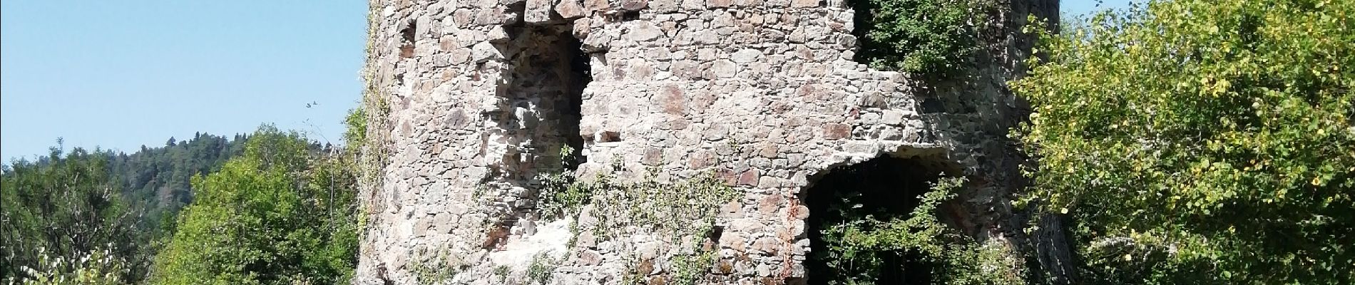
Chartreuse Ste Marie

Papou63patrick
User

Length
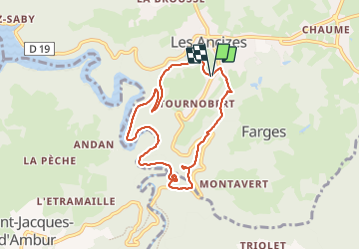
7.6 km

Max alt
698 m

Uphill gradient
217 m
Km-Effort
10.5 km

Min alt
511 m

Downhill gradient
216 m
Boucle
Yes
Creation date :
2023-08-11 08:02:39.916
Updated on :
2023-08-11 10:59:21.858
2h04
Difficulty : Easy

FREE GPS app for hiking
 SityTrail
IGN / Geographical institutes
SityTrail Plus
The world is yours!
About
Trail Walking of 7.6 km to be discovered at Auvergne-Rhône-Alpes, Puy-de-Dôme, Les Ancizes-Comps. This trail is proposed by Papou63patrick.
Photos


Positioning
Country:
France
Region :
Auvergne-Rhône-Alpes
Department/Province :
Puy-de-Dôme
Municipality :
Les Ancizes-Comps
Location:
Unknown
Start:(Dec)
Start:(UTM)
485162 ; 5085283 (31T) N.
Comments